Consultant updates council with high-level overview of suggested solutions over next decade
Woodstock council heard several options to enhance active transportation over the next decade to provide safe and viable routes for non-motorized traffic.
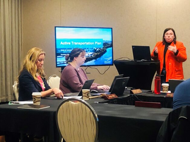
Dillon Consulting’s Jennifer Brown presented what she described as “a high-level overview” of the 10-year plan during the Nov. 14 council meeting held at the Woodstock Best Western.
She pointed to the plan’s vision statement.
“Enable safe, efficient, and enjoyable walking, wheeling, and cycling opportunities in Woodstock for residents of all ages and abilities as a component of daily travel.”
Coun. Julie Calhoun-Williams clarified that “wheeling” in the plan refers to bikes, wheelchairs and other non-motorized vehicles and not motorized off-road machines such as ATVs or quads.
To many Carleton County residents, she noted, “wheeling’ means off-road vehicles, which are not part of the Active Transportation Plan.
Brown explained the plan focuses on improvements to existing routes and proposing new routes.
The plan identifies existing streets, roads and trails and proposes modifications for several. It also recommends the creation of new trails.
The plan listed 14 existing routes, including streets and trails, with recommended improvements for pedestrians and bikers and estimated costs.
Recommendations included the creation of a paved trail along Deakin Drive at an estimated cost between $780,000 and $940,000.
It also recommended a combination of paved trails, buffered bike lanes and advisory lanes along 3.75 kilometres of Connell Street at a cost of $448,220 to $548,150.
Other proposals included a paved trail from Bicentennial Drive to Connell Park Campground and a gravel trail from Orange Street to Helen Street.
The plan recommended upgrades to add “advisory bike lanes” to Kirkpatrick, Helen, Chapel, Orange, and Elm Streets and parts of Main Street and Route 103.
The plan also stretches to a regional level, with bicycle-accessible shoulders recommended for Routes 103, 105, and 550 west of Highway 2 and 555.
The plan also incorporates the existing Trans Canada Trail and proposes regional routes utilizing local trails, various highways, connector roads and resource roads.
The plan identified each project by priority, with Connell Street, Deakin Drive and Main Street-Route 103 deemed high. All other identified streets and trails rated low or medium.
Brown explained the Active Transportation Plan is designed to serve as council’s guideline. She explained council members should consider the plan when debating future development, citing the residential expansion north of Deakin Drive as an example.
Brown described partnerships with developers as key, noting new subdivisions must include at least eight per cent of the land designated for public use. She suggested council could incorporate that public land for a trail system through the subdivision.
“This won’t come as a shock to any developer,” Brown said.
Council passed a motion to accept the plan, but Mayor Trina Jones reminded them and the public they were not accepting every recommendation or expenditure in the plan.
Jones said council and staff could study the plan over the next decade to see what proposals they could incorporate into future developments. She added council could potentially tackle some projects as it finalizes its budget for 2024.

